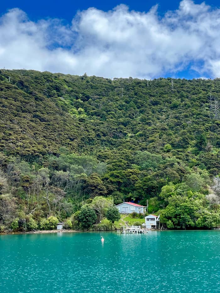
Heritage site
Meretoto / Ship Cove
Cook's anchorage
See the cruiseMap your stop
Find out about 30 stops
Start by picking a route; tap a pin or stop for its note and Google Maps.
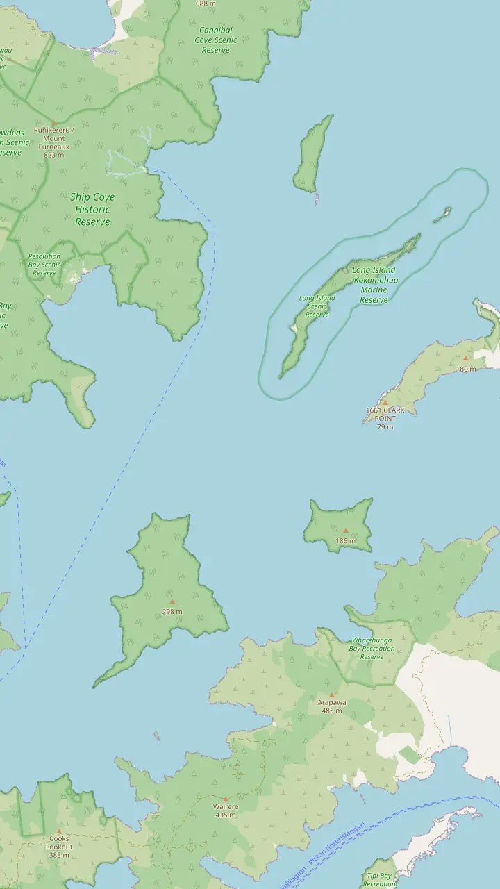
Cook's anchorage and the start of the track, reached only by boat.
Google MapsA sheltered bay inside Resolution Bay with a campsite beside the track.
Google MapsA predator-free bird sanctuary opposite Ship Cove, about 32 km from Picton, with a jetty and a summit lookout.
Google MapsA cove just north of Ship Cove with a campsite.
Google MapsThe larger island of a marine reserve at the mouth of the sound, established in 1993.
Google MapsA rocky point on the peninsula where rats and possums are kept from reinvading.
Google MapsThe large island between the sound and Tory Channel.
Google MapsThe remains of the Perano whaling station, which worked from 1911 to 1964; the site is closed.
Google MapsThe bay beside Fishermans Bay where New Zealand's first onshore whaling station opened in 1829.
Google Maps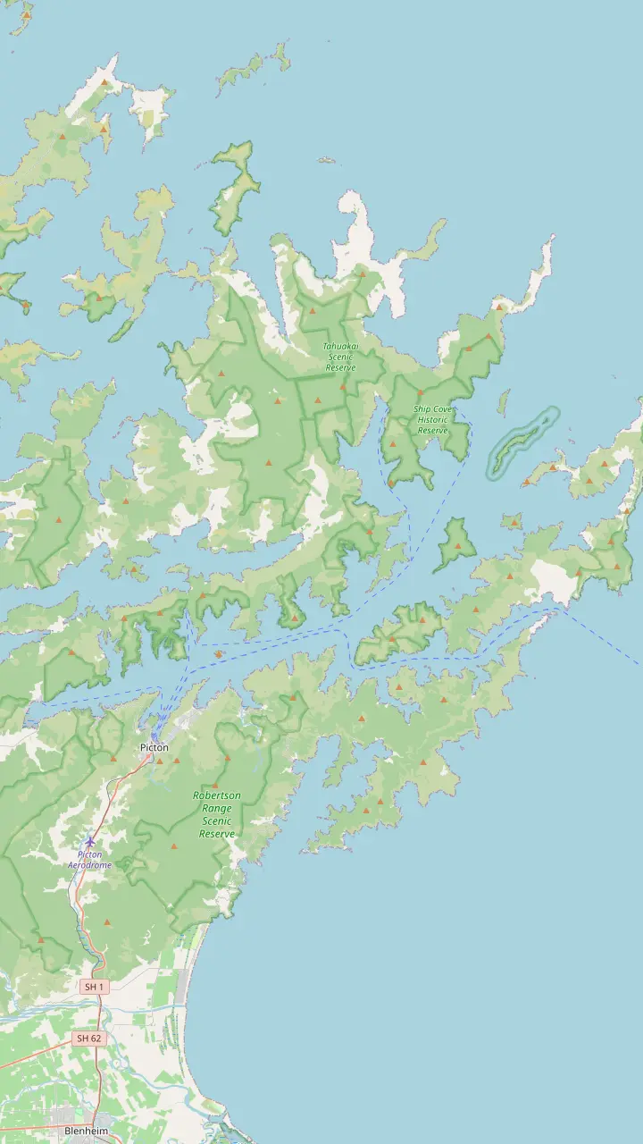
The ferry port and the base for every cruise and water taxi on the sound.
Google MapsA bay just west of Picton where cruise ships berth at Waimahara Wharf.
Google MapsA bay east of Picton with Waikawa Marae and a buoyed swimming area.
Google MapsA cove where tame fish are fed and fishing is banned.
Google MapsA small island sanctuary in the inner sound, free of predators.
Google MapsA bay in the inner sound with a lodge reached by boat.
Google MapsA bay with cabins and campsites, reached by road or boat, and short forest walks.
Google MapsA bay in Grove Arm on Queen Charlotte Drive.
Google MapsA bay with a DOC campsite below the track.
Google MapsThe jetty below Torea Saddle, where boats meet walkers.
Google MapsA ridge-top campsite above the bay of the same name.
Google MapsA long inlet with lodges, where a small antimony mining town stood in the 1880s.
Google MapsA predator-free island sanctuary with a campsite.
Google MapsA quiet bay on the Arapaoa side of the outer sound.
Google MapsCook's anchorage and the start of the track, reached only by boat.
Google MapsA predator-free bird sanctuary opposite Ship Cove, about 32 km from Picton, with a jetty and a summit lookout.
Google Maps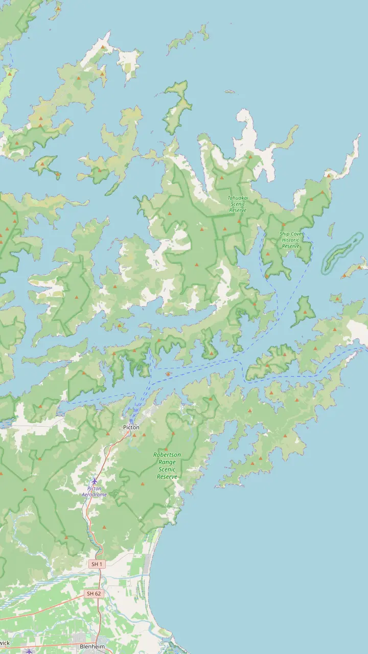
Cook's anchorage and the start of the track, reached only by boat.
Google MapsA sheltered bay inside Resolution Bay with a campsite beside the track.
Google MapsA long inlet with lodges, where a small antimony mining town stood in the 1880s.
Google MapsA small bay with a campsite and a resort nearby, at the foot of the climb to the ridge.
Google MapsThe road end on the ridge where the track crosses into private land.
Google MapsA ridge-top campsite above the bay of the same name.
Google MapsA ridge-top campsite with wide views over both sounds.
Google MapsA bay below Torea Saddle with a campsite, near Portage.
Google MapsA short side trip from the track to a lookout above the inner sound.
Google MapsA bay with cabins and campsites, reached by road or boat, and short forest walks.
Google MapsA beech-shaded bay with a campsite, an hour from the track end.
Google MapsThe southern end of the track, with a jetty, toilets and a car park.
Google MapsThe ferry port and the base for every cruise and water taxi on the sound.
Google Maps© OpenStreetMap contributors, map data
A quiet cove at the outer end of the sound holds some of the deepest history in the country: Polynesian navigators, the iwi of Tōtaranui, and James Cook's favourite anchorage. What to know before your boat lands.
Editorial team, queencharlottesoundcruise.click · Updated November 8, 2026 · Quick read: 8 min
Overview
Meretoto/Ship Cove sits near the open, northern end of Queen Charlotte Sound, a small bay of calm water under steep coastal forest. The only way in is by boat, either your own or a commercial cruise from Picton.1 Bird song fills the bush behind the beach, and DOC notes that more than 125 years of protection have left the setting largely as Cook would have found it, apart from paths, panels and toilets for visitors.7
Ashore you find a memorial, information panels on the cove's past, a short bush walk to a waterfall and a picnic table shaped like a waka.8 The Waterfall Track is about 40 min return through the forest and makes a good leg-stretch while a boat waits.9 Camping is not allowed in the cove, though there are toilets, and the Queen Charlotte Track begins in the cove for anyone walking south.10,11
Look closely at the monuments. Memorials to Cook were raised in 1913 and 1920, and in recent years three pouwhenua have been added that depict Kupe and the local tribes.12 The carved bollards at the bridge represent the iwi of the area, and one carved pou tells of Kupe and the giant wheke, the octopus of the legend.13,14 Together they turn a European memorial site into a place where both histories stand side by side.
Cook in New Zealand
| Measure | Figure | Source |
|---|---|---|
| Visits to Ship Cove | Five18 | Official track site |
| Days at Ship Cove | 1704 | DOC |
| Days at Ship Cove | 10527 | Destination Marlborough |
| Days in New Zealand | 32828 | Both |
| Endeavour crew | 9429 | Destination Marlborough |
The two official counts of Cook's days in the cove differ; both are shown as their sources state them.4,27,28
The Māori name for the sound is Tōtaranui, after the tōtara trees that grew there and were valued as a resource.2 The official track site writes it without a macron, describing Queen Charlotte Sound, Totaranui, as a key area for the Māori who lived and travelled there.20 DOC records at least 800 years of Māori occupation in the Sounds, sustained by seafood from the sheltered inlets and by the birds of the forest.15
Ship Cove matters to many iwi. DOC names Ngāti Kuia, Rangitāne and Ngāti Apa among its early inhabitants, Ngāti Toa as a later iwi, and Te Ātiawa as today's guardians.21 When the Endeavour arrived, DOC says the iwi at Meretoto were the Kurahaupō tribes: Rangitāne o Wairau, Ngāti Apa Ki te Rā Tō and Ngāti Kuia.22 Picton itself, known as Waitohi, was settled by Te Ātiawa people who came from Taranaki in 1828, and their marae still stands at Waikawa Bay today.23,24
Tradition gives the region a grand shape. In one telling, the Marlborough Sounds are Te Tau Ihu o Te Waka a Māui, the carved prow of Māui's canoe.25 In another, set down by DOC, the South Island is the canoe of Aoraki, and its sunken prow forms Tōtaranui and Pelorus Sound/Te Hoiere.26 Many place names in the outer sounds also recall the voyages of Kupe. These stories belong to the iwi; visitors are best served by hearing them from iwi guides and the panels at the cove.
James Cook sailed the Endeavour into Meretoto on 15 January 1770, a few months after landing at Tūranganui-a-Kiwa/Poverty Bay with a crew of 94.17,29 He came back again and again: the official track site and Destination Marlborough both count five visits between 1770 and 1777.18,27 It was here that sustained contact between Māori and Europeans first took hold, with iron tools, fish hooks, vegetables and animals changing hands.38,39
How long did he stay? DOC says Cook spent 170 of his 328 days in New Zealand at Ship Cove, while Destination Marlborough's heritage page gives 105 days in the cove, so the two official sources count differently.4,27 Either way it was his main base. DOC adds that it is the only place he visited on all three voyages, one of only two such sites in the South Island, and the only anchorage of his last voyage.4
The cove fed and healed his crews. Cook found a plant there now called Cook's scurvy grass, a source of vitamin C against scurvy.40 Joseph Banks, the naturalist on the first voyage, wrote of waking to a dawn chorus he likened to small bells.41,42 DOC describes the frequent meetings at Meretoto as laying the ground for the country's bicultural heritage, a weight that is easy to feel when you stand on the quiet beach today.43
Plan your visit
Choose by time, energy and how much history you want.
If I want a short guided trip
A Ship Cove cruise
The cruise this page books lasts about 3 hours with a live guide.
If I want to walk from the cove
The first leg of the track
The opening leg to Resolution Bay covers 4.5 km.36
If I love birds
Add Motuara Island
Saddleback and parakeets live on the island.37
If I want the history in depth
Read every panel ashore
Three places, one story
Heritage site
Cook's anchorage
See the cruise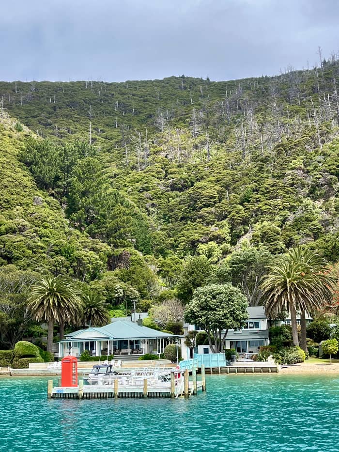
Wildlife
Bird sanctuary opposite
See the cruise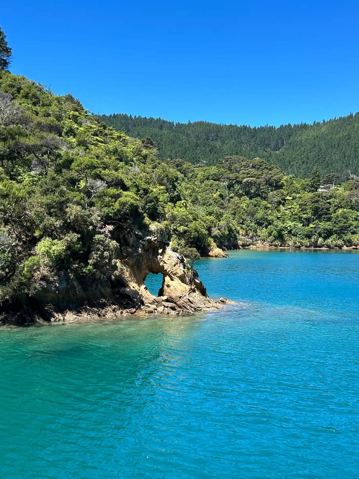
Later history
Mining town of the past
See the cruiseSo who is Queen Charlotte Sound named after? Cook gave the sound the name of Queen Charlotte, wife of King George the Third, according to the official track site.5 DOC confirms that Queen Charlotte was the name Cook chose for the waterway, which had long been Tōtaranui to the people living on its shores.38,2 Both names now travel together on official signs and in DOC's own naming of the area.
The naming came with a claim. On 31st January 1770 Cook raised the flag on the summit of Motuara Island and proclaimed British sovereignty, as the official track site records it.56 DOC's page for Motuara also marks it as the place where, in 1770, Cook proclaimed British sovereignty over the South Island.57 Today a cairn near the summit, a short climb from the island jetty, recalls the moment for walkers who make the climb.32
European sightings came earlier. DOC records that the Dutch navigator Abel Tasman sighted the Sounds in 1642 and sheltered nearby, but he and his crews never came ashore here.16 Cook, born in 1728, returned to the cove on each of his Pacific voyages before he was killed in Hawaii in 1779, during the third.58,59,4 No other place in the country drew him back on every voyage, and each time he made the cove his base.4,3
Boat trips to the cove
Pick the trip and the number of people, and compare.
Weigh up 3 options
Pick the trip and the number of people, and compare.
≈
View≈
View≈
ViewGetYourGuide's starting prices, converted at the ECB reference rate; exact pricing appears when you book.
Through the centuries
Long before
DOC records at least 800 years of Māori occupation.15
1642
Abel Tasman sights the Sounds but never lands.16
January 1770
The Endeavour anchors on 15 January 1770.17
1770 to 1777
Cook comes back to the cove five times in all.18
1896
The country's first historic reserve.6
2019
A pōwhiri and flotilla mark the first encounters.19
Opposite the cove lies Motuara Island, about 32 km from Picton by boat.30 Rats were eradicated in 1992, and DOC has since moved saddleback, South Island robin, yellow-crowned parakeet and the Maud Island frog onto it.37 The island also serves as a crèche for rowi, a rare kiwi whose chicks grow up here before going home.60 DOC counts fewer than 500 rowi left, and chicks return to the wild once they weigh 1 kg.61
A short path climbs from the jetty. The Motuara Island Lookout Track is 1.6 km return and about 40 min, passing a bird viewing station about 5 minutes from the jetty and Cook's Cairn near the 128 m summit.31,32 At the island's southern tip, the smaller Hippa Island once held a Māori pā built before Europeans arrived.62 Check your bags and shoes for seeds and stowaway pests before you step ashore, as the island's birds depend on it staying free of predators.
The island's recovery is recent. Around the start of the 20th century Motuara was burned off and grazed by sheep, then used for an experimental Angora goat farm.63 Destination Marlborough records it as a reserve from 1920, and DOC says the forest has regenerated over the last 70 years without replanting.64,65 The South Island saddleback arrived in 2009, descended from 36 birds rescued in 1964.66
Video
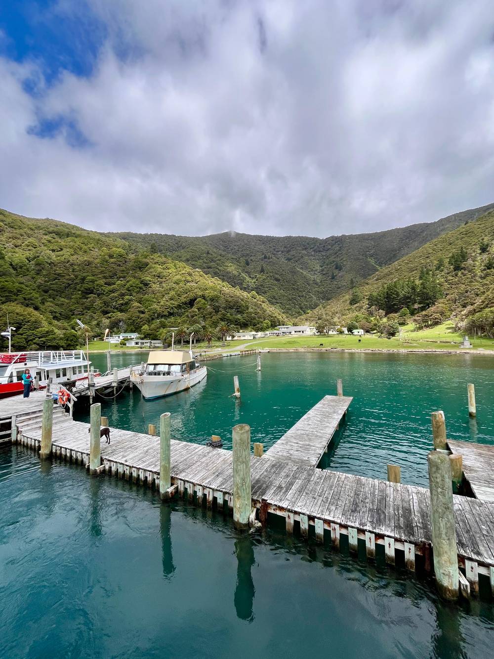
Knot Nauti on YouTube · The video waits until you tap play to load.
Meretoto/Ship Cove is the only location visited on all three of Cook's voyages in the 1770s, one of only two in the South Island, and the only anchorage in his final voyage.
At the cove
In 1896 Ship Cove was made the country's first historic reserve, and it has been looked after as a heritage site ever since.6 DOC now treats it as a key site for the stories of Polynesian navigation and of first contact, and the panels around the cove tell both. The Tahitian navigator Tupaia is honoured for easing those first meetings, and Te Ātiawa o Te Waka-a-Māui keep a deep connection to him.67
In 2019 an official event at Meretoto, with a pōwhiri and a flotilla, recognised the cove as a place where Māori and Europeans first met on shore at Tōtaranui.19 The neighbouring peninsula has its own modern work: the Bottle Rock Peninsula, between Resolution Bay and Ship Cove, belongs to a project that keeps rats and possums out without fences.48 Traps line parts of the path, so stay on the track.
Further along, other bays carry later chapters. Shore whaling began in New Zealand at Te Awaiti in 1829, beside Fishermans Bay in Tory Channel.50 The Perano station there worked from 1911 to 1964 and is now closed to visitors for safety.49 In the 1880s Endeavour Inlet, just south of the cove, held a small antimony mining town, and the Antimony Track still climbs past the old tailings.33,34 Like Ship Cove, the inlet has no road.35 A cruise past these bays reads like a timeline of the sound.
Most visitors arrive on a cruise from Picton. The listing this page books, a Marlborough Sounds and Ship Cove cruise, spends about 3 hours on the water, is guided in English, and is priced from $86. Its boat varies with numbers, from a small single-hull vessel to a two-deck catamaran. Free cancellation is possible up to 24 hours ahead, which helps when the forecast turns and you want to move the trip to a calmer day.
If you would rather walk, take a boat out and follow the track's opening leg to Resolution Bay, 4.5 km that DOC times at about 2 hr, with a saddle lookout after 50 minutes.36,68 Some trips add a landing on Motuara Island, such as the sanctuary and dolphin cruise from Picton that includes a guided walk on the island. Pack water, a light jacket and insect repellent; there are toilets but no shop or café.
Respect matters here. The site is protected, the carvings carry iwi meaning, and DOC asks visitors to leave all wildlife undisturbed and to use a zoom lens rather than get close.55 Do not feed the weka or the birds on Motuara, since human food can make native birds sick.69 Take every scrap of rubbish back to Picton, keep voices low near the carvings, and leave the cove as quiet as you found it.
FAQ
It refers to the tōtara trees that grew there, a valued resource.2
He entered Meretoto/Ship Cove on January 15, 1770, during his first Pacific voyage.17
He raised the flag on its summit on 31st January 1770 and proclaimed British sovereignty there.56
Camping is not permitted in the cove, but there are toilets.10
The Waterfall Track leads into the forest behind the cove to a small waterfall.9
Sources
Mail boat, water taxi or a day on the track? Ask a real person here.