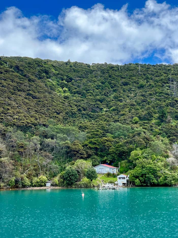
Comfort
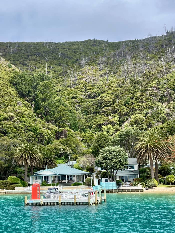
Waterside lodge
Bays served by boat
- Reached byBoat or helicopter25
- ExampleEndeavour Inlet
- Good forTrack walkers
Map your stop
The quick version
Queen Charlotte Sound runs north-east from Picton at the top of the South Island, past the inner bays, Endeavour Inlet and Ship Cove to Motuara and Long Island at its mouth.
Distances and access
Find out about 30 stops
Start by picking a route; tap a pin or stop for its note and Google Maps.
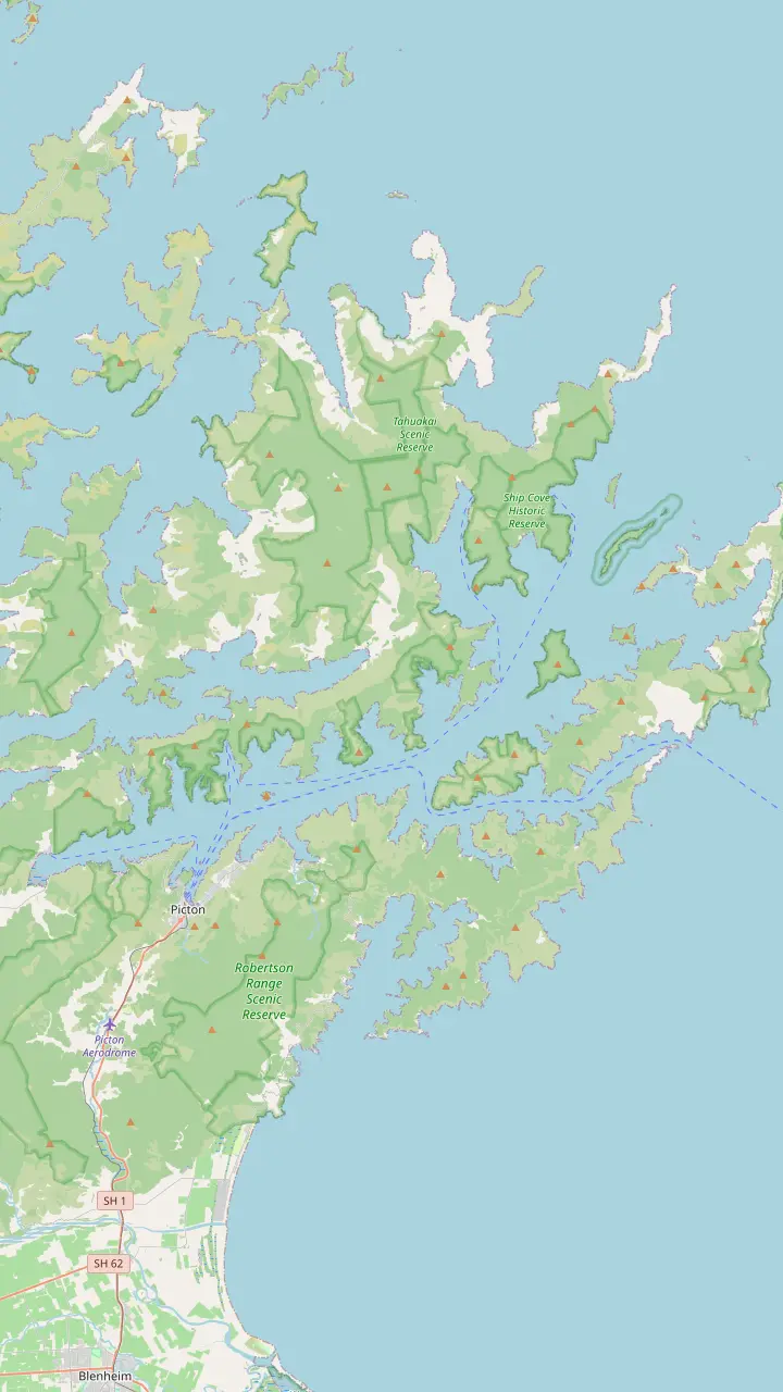
The ferry port and the base for every cruise and water taxi on the sound.
Google MapsA bay just west of Picton where cruise ships berth at Waimahara Wharf.
Google MapsA bay east of Picton with Waikawa Marae and a buoyed swimming area.
Google MapsA cove where tame fish are fed and fishing is banned.
Google MapsA small island sanctuary in the inner sound, free of predators.
Google MapsA bay in the inner sound with a lodge reached by boat.
Google MapsA bay with cabins and campsites, reached by road or boat, and short forest walks.
Google MapsA bay in Grove Arm on Queen Charlotte Drive.
Google MapsA bay with a DOC campsite below the track.
Google MapsThe jetty below Torea Saddle, where boats meet walkers.
Google MapsA ridge-top campsite above the bay of the same name.
Google MapsA long inlet with lodges, where a small antimony mining town stood in the 1880s.
Google MapsA predator-free island sanctuary with a campsite.
Google MapsA quiet bay on the Arapaoa side of the outer sound.
Google MapsCook's anchorage and the start of the track, reached only by boat.
Google MapsA predator-free bird sanctuary opposite Ship Cove, about 32 km from Picton, with a jetty and a summit lookout.
Google Maps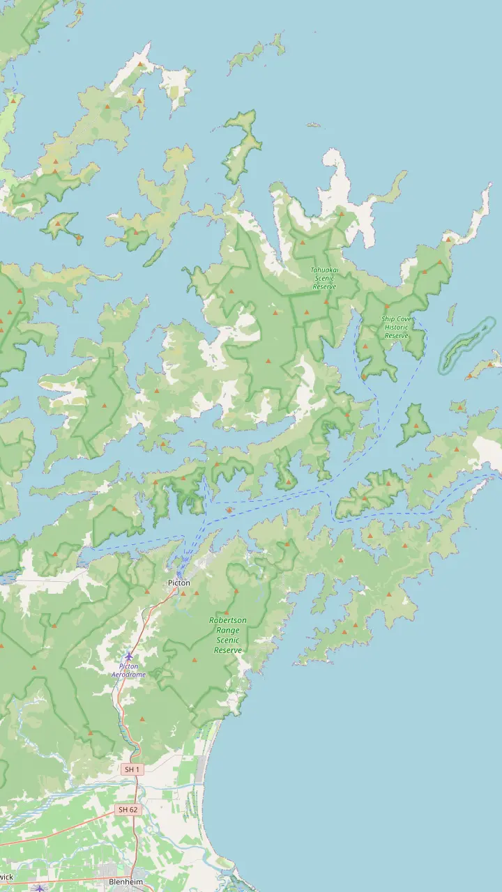
Cook's anchorage and the start of the track, reached only by boat.
Google MapsA sheltered bay inside Resolution Bay with a campsite beside the track.
Google MapsA long inlet with lodges, where a small antimony mining town stood in the 1880s.
Google MapsA small bay with a campsite and a resort nearby, at the foot of the climb to the ridge.
Google MapsThe road end on the ridge where the track crosses into private land.
Google MapsA ridge-top campsite above the bay of the same name.
Google MapsA ridge-top campsite with wide views over both sounds.
Google MapsA bay below Torea Saddle with a campsite, near Portage.
Google MapsA short side trip from the track to a lookout above the inner sound.
Google MapsA bay with cabins and campsites, reached by road or boat, and short forest walks.
Google MapsA beech-shaded bay with a campsite, an hour from the track end.
Google MapsThe southern end of the track, with a jetty, toilets and a car park.
Google MapsThe ferry port and the base for every cruise and water taxi on the sound.
Google Maps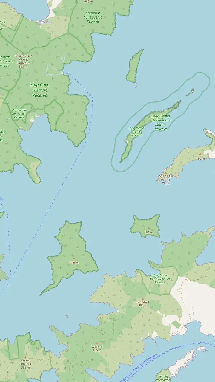
Cook's anchorage and the start of the track, reached only by boat.
Google MapsA sheltered bay inside Resolution Bay with a campsite beside the track.
Google MapsA predator-free bird sanctuary opposite Ship Cove, about 32 km from Picton, with a jetty and a summit lookout.
Google MapsA cove just north of Ship Cove with a campsite.
Google MapsThe larger island of a marine reserve at the mouth of the sound, established in 1993.
Google MapsA rocky point on the peninsula where rats and possums are kept from reinvading.
Google MapsThe large island between the sound and Tory Channel.
Google MapsThe remains of the Perano whaling station, which worked from 1911 to 1964; the site is closed.
Google MapsThe bay beside Fishermans Bay where New Zealand's first onshore whaling station opened in 1829.
Google Maps© OpenStreetMap contributors, map data
From the ferry port at its head to the islands at its mouth, the sound is a chain of bays, each with its own jetty, lodge or campsite. Here they are in order, with what you find ashore and how to get there.
Editorial team, queencharlottesoundcruise.click · Updated November 8, 2026 · Quick read: 7 min
Overview
Where is Queen Charlotte Sound? It is the long waterway that opens north-east from Picton, on the northern tip of the South Island, and it is one of the three main bodies of water in the Marlborough Sounds, with Kenepuru and Pelorus.1 Tourism New Zealand describes the Sounds as ancient river valleys drowned by the sea, with 1500km of coastline between them.6 On a map the result looks like a hand of green fingers reaching into blue water.
Picton sits at the head of the sound. It is a small port of fewer than 5,000 permanent residents and the main gateway for the ferries between the islands.2 The ferries reach it by threading Tory Channel and then the inner sound, and the whole crossing from Wellington is 96 km.7 Arapaoa Island, the second largest island of the Sounds, divides Tory Channel from the outer reaches of the sound.8
Read the map in sections. The inner sound, closest to Picton, is narrow and busy with ferries and marinas. The middle sound widens past Allports Island and the bays below the Queen Charlotte Track ridge. The outer sound runs out past Endeavour Inlet and Ship Cove to Motuara and Long Island at the entrance, where the open water of Cook Strait begins. DOC manages more than 50 reserves across this maze of land and water.1
What is where
| Bay | Ashore | Access |
|---|---|---|
| Shakespeare Bay | Cruise ship wharf | Road |
| Waikawa Bay | Marae, swimming area | Road |
| Double Cove | Fish feeding, no fishing | Boat |
| Mistletoe Bay | Eco village, walks | Road or boat |
| Torea Bay | Jetty, campsite nearby | Road or boat |
| Endeavour Inlet | Lodges, mining relics | Boat only |
| Ship Cove | Cook memorials, waterfall | Boat only |
| Motuara Island | Bird sanctuary, lookout | Boat only |
Places and access as the official sources describe them.16,9,10,23,11,24,13,14
Just west of the town, Shakespeare Bay holds Waimahara Wharf, where cruise ships can berth; they also use Waitohi Wharf in central Picton.16 East of the town, Waikawa Bay is where Te Ātiawa moved after the Crown bought the land of Waitohi Pā in 1850, and Waikawa Marae stands there still.9 The bay also holds one of the buoyed swimming areas, reserved for swimming between Labour Weekend and Easter.17,18
Close to town, Kaipupu Wildlife Sanctuary is a good spot for fur seals basking on the rocks.19 Further out, Double Cove is a no-fishing area where tame blue cod, herring and mullet are fed regularly and gather around visiting boats.10 Allports Island, off the eastern shore, is one of the predator-free island sanctuaries named by Tourism New Zealand, along with Motuara, Long and Blumine.3
Lochmara Bay, in the inner sound, has a lodge reached across the water. To the south-west, Grove Arm curls towards Anakiwa past Ngākuta Bay and Davies Bay, close to the southern end of the Queen Charlotte Track.20 Queen Charlotte Drive follows this shore between Picton and Havelock, the main road in the Sounds, and DOC warns that other roads are narrow, winding and mostly unsealed.4,21
Mistletoe Bay, below the ridge near Te Mahia Saddle, is a bay you can reach by road as well as by sea, and a handy stop if you are exploring by car.30,11 It has an eco village with cabins and campsites, and DOC's James Vogel Track is a 45 minute circle through the bush behind it, with a 1 hour Peninsula Walk nearby.23 Above it, a side path from the track leads to the Onahau Lookout, worth the detour for its view over the inner sound.31
Torea Bay and Portage sit on either side of the low Torea Saddle, the old canoe-hauling route between Queen Charlotte and Kenepuru sounds.32 Boats meet walkers at the Torea Bay jetty, and Cowshed Bay nearby has a DOC campsite.11 Further along the ridge, Kumutoto Bay and the Bay of Many Coves lie below the track, with a DOC campsite high above each and a resort on the water at Bay of Many Coves. From the ridge above, you look down into both of them and across to Kenepuru Sound on the other side.33
Out in the middle of the sound, Blumine Island is a bird sanctuary with a campsite, and Joseph Banks wrote of waking to birdsong on these shores during Cook's first voyage.3,34 Look for mussel buoys as you cross: the Marlborough Sounds have over 500 mussel farms producing around 70% of the national harvest, and king salmon have been farmed in sea pens here for more than 25 years.35,36 The ferries pass right by both kinds of farm on their way in to Picton.
Choose your bay
Pick by how far you want to go and what you want to find ashore.
If I have half a day
The inner sound
If I want history
The outer sound
If I want birds
The island sanctuaries
Motuara, Long, Blumine and Allports are predator-free.3
If I am driving
Mistletoe Bay and Torea
Both bays are reached by road as well as boat.30
If I want quiet nights
A boat-access lodge
Some lodges can only be reached by boat.25
Where to sleep
Comfort
Bays served by boat
Budget
Simple and close to nature
See the bays
Flexible
Town beds, day trips out
See the baysEndeavour Inlet in Queen Charlotte Sound is the long arm that reaches inland north of Camp Bay. At its head, a small town grew around antimony mines in the 1880s, and the Antimony Track still leads up past old mine tailings in about 40 min return.12,48 Lodges stand along the inlet today, among them Furneaux Lodge, and like Ship Cove and Resolution Bay the inlet has no road at all, so every guest, supply and parcel arrives by water.24
South of the inlet, Camp Bay and Punga Cove sit side by side, with a DOC campsite, a resort and the start of the long ridge stage of the track.49,33 East of it, Resolution Bay holds Schoolhouse Bay, once home to the local school, and a DOC campsite.50 Beyond lies Meretoto/Ship Cove, Cook's anchorage, reachable only by boat.13 Cannibal Cove, just north again, has a campsite on its beach.
At the mouth of the sound, Motuara Island sits about 32 km from Picton, a bird sanctuary with a jetty and a summit lookout.14 Long Island and Kokomohua Island, 35 km from Picton, form a marine reserve established in 1993, reached in anything from 30 minutes to several hours, by sea state and type of boat.15,39 Landing on Long Island is discouraged, but large blue cod are abundant in the water around it.51,52
See the bays by boat
Compare the boat trips that call at the bays.
Weigh up 3 options
Compare the boat trips that call at the bays.
≈
View≈
View≈
ViewGetYourGuide's starting prices, converted at the ECB reference rate; exact pricing appears when you book.
Heading out by boat
Leaving port
The ferry port at the head of the sound.2
Inner sound
Middle sound
Jetties below the track ridge.11
Outer bays
Lodges, campsites and mining history.12
Cook's cove
Cook's cove, a heritage site reached by boat only.13
The mouth
Accommodation in Queen Charlotte Sound comes in three broad kinds: lodges and resorts on the water, DOC campsites, and beds in Picton. Some waterside places can only be reached by boat or helicopter, which is a large part of their appeal.25 There are no DOC huts anywhere on the Queen Charlotte Track, but campsites, private camping grounds, resorts and homestays line the route, and some of them sit right on the water.5,25
Lodges cluster where boats call: Furneaux Lodge in Endeavour Inlet, Punga Cove beside Camp Bay, the Bay of Many Coves resort, the lodge at Lochmara Bay and the eco village at Mistletoe Bay. On some morning cruises you can step off at Punga Cove or Furneaux Lodge for a meal and catch the mail boat back later in the afternoon.53 Ask each host about meals, bedding and boat times before you book, as the outer bays have no shops.
DOC's campsites along the track each have toilets and water, and they must be booked in every season; open fires are banned on the track, so bring a stove.26,27,28 If you prefer a town base, Picton has hotels, motels, backpackers and holiday parks, and the official track site advises booking ahead, especially in the busy season.29 Walkers off the ferry reach the main cruise office in about 10 minutes on foot, a handy base if you arrive without a car.54
Video
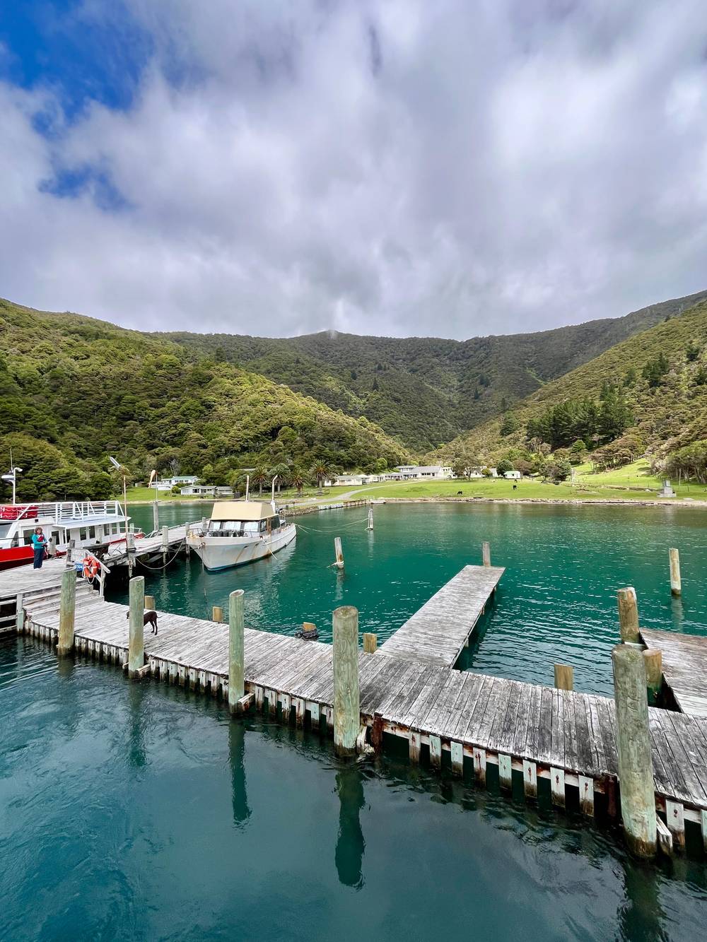
World Family Explorers on YouTube · The video waits until you tap play to load.
With 1500km of New Zealand's coastline, Marlborough Sounds is a collection of ancient sunken river valleys filled with the waters of the Pacific Ocean.
Before you head out
Boats are the buses of the sound. Water taxis leave from Picton, and DOC lists Havelock and French Pass as other departure points for parts of the Sounds, with yachts, launches and sea kayaks for hire.55 The working mail boat changes area by the day: Monday and Thursday cover the inner sound, Tuesday and Friday head into Tory Channel, and later in the week it reaches East Bay and Endeavour Inlet.43
On the water, rules keep everyone safe. The council's navigation bylaw asks for 5 knots or less within 200m of shore or a dive flag, and everyone on boats of 6m or less must wear a lifejacket.45,44 Small craft must keep well clear of the ferries and cruise ships that share the inner channel.56 Kayaks are hard to see in wind and chop, and paddlers do well to wear bright colours and keep clear of the ferry lane in the inner sound.46,56
By land, Queen Charlotte Drive links Picton with Havelock and with the side road to Anakiwa, while Kenepuru Road climbs to the saddles above the middle sound.57,58 DOC explains that the Sounds Foreshore Reserve keeps most bays and beaches open to the public, as a strip about 20-metre wide above high water, even where the land behind is private.59,60 Respect nearby homes and private jetties when you do, and ask before tying up at a jetty.
FAQ
DOC gives the distance as approximately 32 km by water, opposite Ship Cove.14
Endeavour Inlet, Resolution Bay and Ship Cove can only be reached by sea.24
There are DOC campsites, private campgrounds, resorts and homestays instead.5
It runs between Picton and Havelock; other roads are narrow and mostly unsealed.4
The Long Island - Kokomohua Marine Reserve was established in 1993.39
Sources
Mail boat, water taxi or a day on the track? Ask a real person here.